Principal Investigator
Ian Godfrey
Investigators Annual Report IAR, 2025–2026
Supporting Author
José Pablo Sibaja Brenes
Universidad Nacional de Costa Rica
Permit / Study
HAVO-2025-SCI-0046
Study #: HAVO-00910
Research Site
Hawaiʻi Volcanoes National Park
Kīlauea Volcano, Halemaʻumaʻu crater
Thermal Imaging System
FLIR T865
70 mm 6° IR lens

Executive Summary

Radiometric imaging or thermal infrared imagery that measures absolute temperature is one of the most powerful remote sensing tools available to volcanic observatories. Unlike standard visual cameras, it turns heat into quantitative data, making it ideal for detecting subtle changes that often precede eruptions or shifts in degassing behavior.

Radiometric sensors measure pixel-level temperature values, not just relative brightness. This allows volcanic observatories such as the USGS, Hawaiian Volcano Observatory or INGV to build time series datasets of thermal behavior across vents, fissures, and plume structures.

The FLIR T865 has now been field tested in collecting quantifying data of the periodic eruption episodes of the Kilauea Volcano inside the U.S. Hawai’i Volcanoes National Park.

The data sets collected can continue the supporting measures of; eruption forecasting & early warning detection systems, degassing quantification & plume dynamics, lava flow tracking & hazard mapping, public safety & risk management, potential leveraging of components for a multi-purpose/ multi-platform integration for a variety of applications managed collectively.

What radiometric imaging actually captures can amount to valuable data sets for scientists and volcanic observatories along with hazard mitigation and safety officials tasked with managing the site during an eruption.

Radiometric imaging transforms volcano monitoring from qualitative observation quantitative thermal intelligence. It supports earlier eruption detection with a more accurate degassing analysis, along with real-time hazard mapping capabilities which are data-driven IR thermal images that can be used for public safety management decisions.

When integrated with UAS systems, gas sensors, and AI models, it becomes a cornerstone technology for next generation volcanic observatories and hazard mitigation frameworks.

Kilauea lava fountaining during eruption Episode 40 at Hawaii Volcanoes National Park Researcher using a FLIR T865 thermal camera during Kilauea volcano field research
Ongoing lava fountaining at the Halemaʻumaʻu crater of the Kilauea Volcano on January 12th, 2026 for the #40 eruption episode at Hawaii Volcanoes National Park.
Research Design Objectives

Radiometric monitoring in volcanic surveillance

Radiometric monitoring has become an essential component of modern volcanic surveillance systems due to its ability to detect and quantify thermal anomalies associated with magmatic activity.

Thermal precursor signals, including elevated fumarole temperatures, expanding thermal anomalies, the emergence of new hotspots, and variations in thermal inertia, often provide early indications of subsurface magmatic processes. These phenomena may reflect increased magmatic gas flux, magma migration toward the surface, fracture propagation, or changes in subsurface heat transport mechanisms.

In basaltic volcanic systems such as Kilauea, such thermal signals may appear hours to weeks prior to visible eruptive activity. When integrated with complementary geophysical datasets, including seismicity and ground deformation measurements, radiometric observations substantially improve eruption forecasting accuracy and probabilistic hazard assessment models.

In addition to eruption forecasting, radiometric imaging has emerged as a valuable tool for analyzing volcanic degassing processes and plume dynamics. Thermal imaging techniques enable the measurement of temperature gradients within volcanic plumes, providing insight into plume buoyancy, convective intensity, and atmospheric dispersion behavior.

The characterization of plume thermal structure also supports improved modeling of plume rise and transport. Furthermore, radiometric systems are increasingly integrated with gas monitoring technologies measuring sulfur dioxide SO₂ and carbon dioxide CO₂, enhancing the estimation of volcanic gas fluxes and degassing rates.

Radiometric video systems also provide critical real-time intelligence during active eruptive events. Such systems are capable of mapping active and cooling lava flow boundaries, identifying lava flow front velocity and directional movement, detecting lava tube formation and breakout events, and quantifying volcanic heat flux as an indicator of eruption intensity.

These observations are highly valuable for volcanic observatories and emergency management agencies, as they facilitate rapid hazard map generation, infrastructure risk assessment, and evacuation planning.

Thermal Imaging Methodology

Discussion - Thermal Imaging Methodology and the FLIR T865 in Volcanic Environments

At the Hawai’i Volcanoes National Park, we hope to take aerial images to complement the USGS and HVO with both high resolution RGB (red,green,blue) imaging sensors, and IR (infrared) measurements with a T865 thermal camera and a specialized lens [f=70mm (6°)] IR lens capable of taking accurate thermal images/measurements ranging from -20°C ~ 500°C in general with zoom capability, depending on atmospheric conditions. There are two ranges to the thermal imaging camera -20°C ~ 150°C and 0°C ~ 500°C.

The FLIR T865 Thermal Imaging Camera is a non-contact inspection instrument designed for the safe and efficient evaluation of critical electrical and mechanical equipment in utility and manufacturing environments. Its 180° rotating optical block enables operators to conduct inspections with greater comfort and improved accessibility in challenging locations.

Equipped with advanced capabilities, the camera provides highly accurate temperature measurements down to -40°C, with precision levels of up to ±1°C or ±1%. Additional features such as 1-Touch Level/Span contrast enhancement and laser-assisted autofocus ensure consistent image clarity and reliable thermal analysis.

The T-865 may also be paired with a FLIR Flex View Dual Field of View FOV Lens, allowing users to switch instantly between wide-area and telephoto scanning modes for increased operational flexibility. Alternatively, a 6° field of view FOV infrared lens can be utilized for inspecting small targets from extended distances.


Kilauea Volcano during the active lava fountaining eruption episode # 40. Image overview of the entire Halemaʻumaʻu crater inside Hawai’i Volcanoes National Park.

The FLIR T865 Thermal Imaging Camera incorporates a laser-assisted autofocus system designed to improve target acquisition accuracy and enhance focusing performance during thermal inspections.

The camera operates within the long wave infrared LWIR spectral range of approximately 7.5-14 µm, where atmospheric conditions can significantly influence radiometric measurement accuracy.

In particular, elevated humidity levels introduce substantial measurement uncertainty due to the absorption and emission characteristics of atmospheric water vapor.

Moisture present in the air absorbs a portion of the infrared radiation emitted by the target object before it reaches the detector, resulting in reduced apparent target temperatures, especially over extended distances.

Simultaneously, atmospheric water vapor emits infrared radiation that contributes additional thermal energy to the detector signal, potentially distorting calculated temperature values if atmospheric compensation parameters are not properly configured.

High humidity may also reduce thermal contrast, degrade image clarity, and diminish the visibility of thermal anomalies. These effects become increasingly significant as the measurement distance increases, thereby amplifying radiometric error.

Consequently, accurate long-range thermographic measurements require careful consideration of environmental parameters, including relative humidity, ambient temperature, target distance, reflected apparent temperature, and target emissivity, in order to ensure reliable thermal analysis and data interpretation.


Kilauea Volcano post lava fountaining eruption episode # 40. Thermal infrared overview of the entire Halemaʻumaʻu crater of the Hawai’i Volcanoes National Park.
Lava Fountaining Precursor Activity

Signals before sustained fountaining

The current episodic summit eruption at Kilauea has provided volcanologists with one of the clearest modern examples of repetitive lava fountaining precursor cycles ever documented at an open-vent basaltic volcano.

The eruption sequence, which began in December 2024 within Halemaʻumaʻu crater, is characterized by alternating periods of quiescence, inflation, gas accumulation, and rapid high-fountaining discharge.

Immediately prior to a lava fountaining episode, several precursor signals are consistently observed by the Hawaiian Volcano Observatory.

The most important geophysical precursor is rapid summit inflation, recorded by tiltmeters around the caldera. During repose periods, magma continues rising and accumulating beneath the summit reservoir, causing measurable outward deformation of the volcanic edifice.

As magma pressure increases, low-level volcanic tremor intensifies and shallow seismicity commonly increases beneath Halemaʻumaʻu.

Another highly diagnostic precursor is the onset of low-level spattering or dome fountaining at one or both eruptive vents. Hours to days before major lava fountains begin, observers frequently document weak lava overflows, intermittent bursts of spatter, incandescent vent glow, and small fountain pulses.

These represent the earliest arrival of increasingly a gas rich magma into the shallow conduit system. HVO repeatedly notes that these low-level precursory events may continue for many hours before transition into sustained fountains hundreds of meters high.

Precursor Activity at the Kilauea Volcano
Degassing Behavior

Volcanic gas indicators during the eruption cycle

Degassing behavior is equally important in forecasting eruptive transitions.

Prior to major fountaining, sulfur dioxide SO₂ emissions typically increase substantially as magma ascends toward the surface and decompression allows dissolved sulfur species to exsolve from the melt.

At Kilauea, SO₂ is monitored continuously using ultraviolet spectrometers, scanning DOAS systems, MultiGAS instruments, and airborne gas surveys.

Carbon dioxide CO₂ emissions are also monitored because CO₂ exsolves at greater depth than sulfur-bearing gases and therefore provides insight into deeper magma movement before shallow eruption begins.

The CO₂/SO₂ ratio is one of the most important volcanic gas indicators during the eruption cycle.

The observed cyclic behavior of volcanic gas emissions reflects the progressive ascent of magma and the associated separation of volatiles within the conduit system.

During the deep magma recharge phase, elevated carbon dioxide CO₂ emissions and increased CO₂/SO₂ ratios are typically accompanied by relatively modest sulfur dioxide SO₂ output and measurable summit inflation, indicating the influx of deeper, volatile-rich magma into the reservoir system.

As magma ascends toward shallower levels, SO₂ flux increases rapidly while CO₂/SO₂ ratios decline, coinciding with intensified volcanic tremor, spattering activity, and the onset of vent incandescence and lava overflow.

Halemaʻumaʻu crater of Kilauea Volcano during lava fountaining eruption Episode 40
Halemaʻumaʻu crater of the Kilauea Volcano during the lava fountaining eruption episode #40 on January 12th, 2026.
Thermal image of actively degassing lava lake inside Halemaʻumaʻu crater after Kilauea eruption Episode 40
Thermal representation of the actively degassing lava lake observed inside the Halemaʻumaʻu crater of the Kilauea Volcano post lava fountaining eruption episode #40 January 12th, 2026.
Distance, Relative Humidity and Volcanic Plume Emission Complications

Long-range radiometric sensing

The FLIR T865 thermal imaging platform equipped with the optional f = 70 mm 6° infrared telephoto lens represents a high-resolution long-range radiometric sensing system capable of supporting quantitative thermal investigations in industrial, geothermal, and volcanological environments.

The camera integrates a 640 × 480 uncooled microbolometer detector with a 12 µm pixel pitch and is specifically engineered for precision thermography in applications requiring long-distance thermal observation and radiometric measurement.

The optional 6° × 4.5° telephoto lens substantially increases spatial resolution at long standoff distances by narrowing the field of view and concentrating the detector’s instantaneous field of view IFOV onto a smaller target area.

The narrow field telephoto configuration therefore represents a tradeoff between spatial magnification and situational coverage.

Standard wide-angle lenses supplied with the T-865 platform provide broader thermal situational awareness suitable for general monitoring and close-range surveys, whereas the 70 mm 6° lens is optimized for high-resolution thermal targeting at extended distances.

This capability is particularly advantageous for hazardous volcanic monitoring operations where safe standoff distances are required to mitigate exposure to ballistic ejecta, volcanic gases, unstable terrain, and elevated radiant heat flux.

When integrated with complementary datasets including seismicity, gas flux measurements, deformation monitoring, infrasound observations, UAS thermal mapping, and satellite remote sensing, the FLIR T865 equipped with the 70 mm telephoto lens can contribute substantially to multidisciplinary volcanic hazard assessment, eruption characterization, geothermal infrastructure inspection, and long-range thermal intelligence acquisition.

Distance measurements from thermal analysis Test Point 1 via Google Earth used to support the lava fountaining analysis which is a foundational requirement to accurately measure the near-real apparent temperature of the lava. The distance between the lava fountaining vents and the T-865 Test Point 1 was 2,515 meters or 8,251 feet.
FLIR Thermal Studio Pro screen capture representation of the precursor activity commonly viewed before the onset of the lava fountaining events associated with the ongoing Kilauea eruption inside the Halemaʻumaʻu crater at Hawaii Volcanoes National Park.
Volcanic Plume Distribution

Corresponding Complications for Infrared Imaging

The combined presence of SO₂, CO₂, H₂S, volcanic ash, and condensed water droplets create a highly heterogeneous optical medium.

Infrared radiation propagating through such a plume experiences multiple simultaneous attenuation mechanisms including:

  • Molecular absorption
  • Mie scattering by aerosols and ash particles
  • Refraction caused by thermal gradients
  • Beam diffusion from turbulent convection
  • Partial obscuration by condensed steam

These processes collectively reduce radiometric accuracy and image clarity.

As plume density or path length increases, detected thermal intensity decreases exponentially.

In practical volcanological applications, these effects can produce several important observational artifacts:

  • Apparent reduction in lava temperature
  • Blurring of vent geometry
  • Reduced thermal contrast
  • Delayed autofocus response
  • Spatial distortion of thermal anomalies
  • False thermal gradients within the plume
  • Loss of small-scale thermal detail at long distances


Thermal image of the volcanic plume taken with the T865 Episode #41 emphasizing the cloud cover and atmospheric thermal steam vent dynamic of the volcanic high-altitude environment.

Atmospheric correction methods

Humidity and steam typically produce the greatest overall degradation because water vapor is one of the strongest absorbers in the long-wave infrared region.

These tropical volcanic systems such as Kilauea often present especially challenging imaging conditions due to persistent moisture, VOG production, and highly dynamic convective plumes.

Despite these limitations, radiometric thermal imaging remains highly valuable in volcanic monitoring when combined with proper atmospheric correction methods.

Modern thermal analysis workflows designed to support volcanic observatories should incorporate the following.

  • Emissivity correction
  • Relative humidity compensation
  • Atmospheric transmission modeling
  • Multi-distance calibration targets
  • Simultaneous gas flux measurements
  • Wind field analysis
  • UAS based close range thermal surveys

These correction techniques help compensate for plume-induced attenuation and improve the reliability of quantitative thermal measurements obtained during active volcanic degassing episodes.


Thermal image of the volcanic plume taken with the T865 Episode #40 emphasizing the cloud cover and atmospheric thermal steam vent dynamic of the volcanic high-altitude environment. It is this volcanic plume that is the exact target of the “quick pass” and “hover” UAS measurements designed for phase two oh this research project and associated fieldwork.


Lava Flow Progression Tracking

Continuous radiometric thermal imaging

Continuous radiometric thermal imaging using long range infrared systems such as the FLIR T865 Thermal Imaging Camera equipped with telephoto radiometric lenses provides an effective method for quantitatively documenting these rapid morphological fluctuations in near real time.

The ideal volcanic monitoring framework leverages multiple components collectively.

For this operational lava flow monitoring workflow, scientists and safety officials leverage multiple proven strategies, combining camera setup, radiometric calibration, field deployment, and data interpretation.

The T865 is best used as a fixed, repeatable radiometric monitoring station rather than only as a handheld camera.

Its 640 × 480 IR detector, 7.5–14 µm spectral range, radiometric recording capability, and optional narrow-field lenses make it well suited for documenting active lava margins, flow-front advance, breakouts, lava tubes, crust formation, and post-fountain cooling patterns.

Radiometric thermal datasets permit measurement of vent wall temperatures, fountain thermal intensity, lava flow propagation, spatter accumulation, thermal breakout development, and the spatial migration of degassing pathways while simultaneously enabling comparison with seismic, deformation, gas emission, and infrasonic monitoring datasets.

The use of high-resolution thermal imaging is particularly valuable under conditions of limited visibility caused by darkness, volcanic gas emissions, ash, or condensed steam, where conventional optical observations may be significantly impaired.

For lava flow tracking, place the camera on a stable tripod at a safe overlook with a clear view of the crater floor or flow field.

Use the 6° or 14° lens for distant flow fronts and vents, and a wider lens for broader context.


Thermal image analysis of lava flow activity documented inside the Halemaʻumaʻu crater of the Kilauea Volcano.
What the Eruption Cycles Reveal

Three Episodes, Three Different Expressions of Kīlauea

At Kīlauea, an “episode” does not mean a completely separate eruption. The ongoing summit eruption behaves in cycles: magma and gas recharge beneath the summit, pressure builds, lava fountaining begins, and the system deflates as magma is released. When the fountaining subsides, the summit begins to inflate again as the next cycle develops.

By the time of this field study, that sequence had repeated dozens of times. Episodes 40, 44 and 45 therefore offered three snapshots of the same evolving eruption—and an opportunity to compare how changes in fountain height, duration, lava output and vent behaviour appeared in the thermal record.

The thermal images, together with the associated photographs and videos collected using the T865, support ongoing investigations into variations in lava fountain heights and lava fluid dynamics during the active lava-fountaining episodes occurring within Halemaʻumaʻu Crater at Kilauea.

Episode #44 lava fountaining at the Halemaʻumaʻu crater of the Kilauea Volcano taken during sunset during a cloudy overcast evening.
Episode #44 lava fountaining just after sunset at the Halemaʻumaʻu crater of the Kilauea Volcano.
Episode 40

A Sustained Ten-Hour Pulse

The lava fountaining episode #40 of the ongoing summit eruption of Kilauea occurred on 12 January 2026 and represented a significant lava-fountaining event within the current episodic eruptive sequence at Halemaʻumaʻu.

Sustained lava fountaining commenced during the morning hours and continued until approximately 1804 HST, producing an eruptive episode lasting nearly 10 hours.

The eruption was dominated by activity at the northern vent, which generated sustained lava fountains reaching approximately 250 m (820 ft) above the vent.

Observations indicate that approximately 60% of the crater floor was resurfaced by fresh lava during the episode, demonstrating the substantial volume of magma erupted despite the moderate fountain heights relative to other events in the sequence.

Episode 44

When Lower Fountains Still Move Enormous Volumes of Lava

The lava fountaining episode #44 of the ongoing summit eruption of Kilauea commenced at 1110 HST on 9 April 2026 and concluded at 1941 HST the same day, yielding a total eruptive duration of approximately 8 hours and 31 minutes.

Eruptive activity during Episode 44 was dominated by the northern vent, which generated sustained lava fountains reaching a maximum height of approximately 240 m (800 ft) above the vent.

Effusive activity associated with Episode 44 produced approximately 5.8 × 10⁶ m³ of lava and resurfaced roughly 50% of the Halemaʻumaʻu crater floor.

Analysis conducted by the Hawaiian Volcano Observatory indicated that the eruption achieved peak effusion rates approaching 390 m³ s⁻¹ near 1230 HST, while the average discharge rate throughout the eruption was approximately 189 m³ s⁻¹.

These values demonstrate that significant eruptive output can be maintained even during episodes characterized by relatively moderate fountain heights.

Episode 45

Why Fountain Height Is Only Part of the Story

Episode 45 of the ongoing summit eruption of Kilauea occurred on 23 April 2026 and represented a moderate-intensity lava-fountaining event within the broader sequence of episodic eruptive activity occurring at Halemaʻumaʻu.

Sustained eruptive activity continued for approximately 8.5 hours before concluding at 1001 HST, after which monitoring data indicated a return to lower levels of unrest.

Sustained lava fountaining from the north vent generated fountain heights generally below 300 m (1000 ft), with a documented maximum height of approximately 265 m (870 ft).

The fountain fed an extensive network of channelized lava flows that propagated northward from the vent before branching across large portions of the Halemaʻumaʻu crater floor.

Post-eruption observations revealed a well developed lava transport system that distributed lava throughout the eastern sector of the crater and ultimately resurfaced approximately 50% of the crater floor with newly emplaced lava.

Quantitative assessments indicate that Episode 45 produced an erupted lava volume of approximately 5.2 × 10⁶ m³ (6.8 × 10⁶ yd³).

These values demonstrate that relatively moderate fountain heights can nevertheless be associated with substantial eruptive volumes when sustained over extended periods.

Thermal infrared image post lava fountaining inside the Halemaʻumaʻu crater at the conclusion of the eruption episode.
A Volcano That Rebuilds Itself

How Each Episode Reshapes the Vents

The north and south vents have evolved into classic Hawaiian splatter cones through repeated cycles of:

  • Gas-rich lava jetting.
  • Deposition of semi-molten spatter around the vent rim.
  • Cone-wall welding and thickening.
  • Overflow events that breach portions of the cone.
  • Localized collapse and rebuilding during subsequent fountaining episodes.

Because the current eruption has produced dozens of episodic fountain events since December 2024, the vent morphology is changing on timescales of days to weeks rather than years.

The cones are therefore best viewed as continuously evolving volcanic landforms rather than fixed structures.

Radiometric thermal imaging systems, including long-range instruments such as the FLIR T-865 equipped with a 6° telephoto lens, offer additional capability for continuous monitoring of vent evolution and eruptive activity.

Thermal datasets can reveal active lava pathways, identify localized cone-wall instability, quantify changes in vent geometry, and document thermal anomalies associated with magma migration and degassing.

When combined with photogrammetric and LiDAR derived topographic models, thermal observations provide a comprehensive framework for evaluating both the morphological and thermodynamic evolution of eruptive systems.


Collection of thermal images and infrared data sets taken with the T865 from Volcano House at the end of Eruption Episode #44 showcasing both the north vent and south vent.
No Single Sensor Tells the Whole Story

Building a More Complete Picture of an Active Volcano

The integration of thermal imaging, UAS platforms, seismic arrays, gas monitoring, deformation networks, atmospheric sensing, photogrammetry, satellite remote sensing, and AI-assisted analytics creates a comprehensive multi-parameter volcanic observatory framework.

Such an approach substantially improves eruption awareness, forecasting capability, hazard mitigation, scientific understanding, and public safety during dynamic eruptive activity at Kilauea and other active basaltic volcanic systems worldwide.

Radiometric imaging demonstrates substantially enhanced effectiveness when integrated across multiple observational platforms, creating a comprehensive and multi scale thermal intelligence framework for volcanic monitoring.

Ground based camera systems provide continuous long-term surveillance, while Unmanned Aerial System UAS platforms enable close-range access to volcanic plumes and crater environments that may otherwise be inaccessible or hazardous.

In parallel, satellite systems such as Landsat 8 and Sentinel 2 facilitate the detection and monitoring of regional-scale thermal anomalies.

The integration of these platforms enables the combination of localized precision, continuous surveillance, and global contextual analysis within a unified monitoring framework.

Furthermore, radiometric datasets are particularly well suited for machine learning and predictive modeling applications.

Ground
Ground based camera systems provide continuous long-term surveillance.
Air
Unmanned Aerial System UAS platforms enable close-range access to volcanic plumes and crater environments.
Space
Landsat 8 and Sentinel 2 facilitate the detection and monitoring of regional-scale thermal anomalies.


AERMOD Plot – SO₂ dispersion modelling associated with the Kilauea eruption.


Point source of the SO₂ emissions evaluated in this report: the north and south vents of Halemaʻumaʻu crater.
The People Behind the Fieldwork

Acknowledgements

With certainty first and foremost I would like to recognize Mr. Rickard Lindvall and Mr. Hans Skutberg for their ongoing support from Teledyne FLIR in Switzerland.

With out they’re coordinated effort to support the fieldwork capabilities of the research design the project would simply not have been possible.

It is because of the Teledyne FLIR driven management team that leverages creativity into feasible scientific solutions that are solving real world problems today with emerging technologies that the various dynamic aspects of our environment can be easier to research and understand.

Using the FLIR T-865 at the Kilauea eruption was one of the most insightful pieces of equipment and the resulting data was used by the Hawai’i Volcanoes National Park management team and safety official for their ongoing public safety and hazard mitigation responses.

Additionally, I would like to extend a very sincere “thank you” to Sierra McDaniel the field work research coordinator for Hawaii Volcanoes National Park for her dedication and determination to the many research teams and projects taking place within the national park territory during the ongoing Kilauea eruption cycle and the U.S. Government closure in 2025.

As always it remains important to me to thank the volcanologists and atmospheric scientists for their neutral perspective on these interdisciplinary articles as both OVSICORI-UNA and LAQAT-UNA have been invaluable to the scientific interpretation of the data collected during the fieldwork campaigns.

The article was a result of a coordinated group effort from various scientific and technological professionals and it’s the synergetic performance that leverages people’s passions and brings forth the best we all have to offer each other.


Info anfordern

Optin

Mit dem Absenden stimmen Sie der Datenschutzrichtlinie und Cookie -Richtlinie von FLIR zu.

Vom Discover Center

Anwendungsbericht

Reading Kīlauea in Heat: How FLIR T865 Turns Volcanic Activity into Measurable Data

Mehr erfahren
Anwendungsbericht

How Accessible Thermal Imaging is Transforming University Research and Teaching

Mehr erfahren
Grundlagen

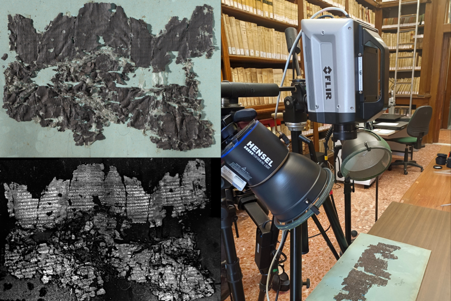
Ancient Secrets Revealed with Flir Thermal Imaging

Mehr erfahren
Grundlagen

Unifying Disconnected Data: When Thermal and Visual Insights Work Together in Materials Science

Mehr erfahren
Grundlagen

Advantages of Thermal Imaging in Materials Science Research

Mehr erfahren
Anwendungsbericht

Flir-Thermokameras helfen Psychologen, die Temperatur zur Stressüberwachung zu nutzen

Mehr erfahren
Anwendungsbericht

Flir T540 Thermographiekamera hilft Schülern bei der Entwicklung von Rennwagen

Mehr erfahren