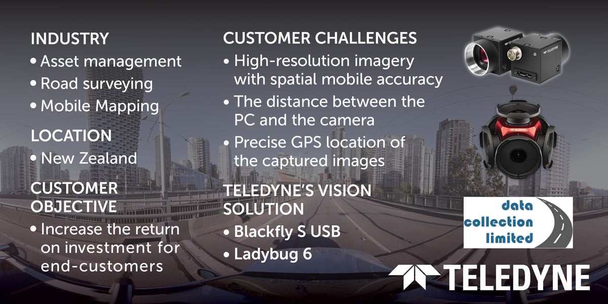
Case Study: Critical infrastructure asset management using Teledyne imaging solutions.
Data Collection Limited advances road inspection, asset, and inventory management by integrating Teledyne’s Blackfly S and Ladybug spherical imaging cameras.
“Having been with DCL for almost 15 years, I’ve watched the company grow and develop the ROMDAS™ system to compete with the most advanced systems in the world. This growth is the result of not only customer-focused policies in R&D and Support but also thanks to great industry relationships and support from our suppliers, of which, TELEDYNE has been fantastic.” - Ben Clotworthy, Operations Manager at DCL
Introduction
Data Collection Ltd (DCL), a New Zealand-based company, specializes in asset and pavement management solutions integral for maintenance, planning, and budget allocation.
The company has developed a leading cost-effective infrastructure asset management technology called (Road Measurement Data Acquisition System). This globally recognized asset management solution follows a modular design for utilizing a variety of cameras and sensors. These cameras and sensors are linked together by an intuitive software platform called DataView™. The system is easily configurable to collect specific data.
With over 30 years of expertise, ROMDAS™ is implemented and trusted by governments, engineers, and researchers globally in over 60 countries.
ROMDAS™ has been adopted as a preferred asset management solution for a number of Public/Government departments, globally: ROMDAS™
- Himachal Pradesh Public Works Department
- Karnataka Public Works Department
- Road Department of Georgia
- Government of Netherlands
Customer Objectives
Increase the return on investment for their customers.
Roads function as arteries for a country’s economy. Governments globally improve, maintain, and budget for this critical infrastructure. ROMDAS™, a premier infrastructure asset management solution, presents highly accurate data for the best return on infrastructure investments.
This wealth of mapping data enables public infrastructure agencies to make informed decisions and ensures the most efficient use of the budget for infrastructure improvement.
Challenges
High-resolution imagery with spatial mobile accuracy
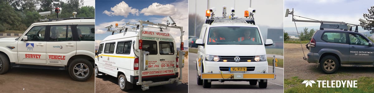
The cameras on ROMDAS™ are used for recording the road corridor for assets, inventory, and for a visual condition of the pavement surface. These cameras are installed on the roof or on the rear of the vehicle which is normally traveling at traffic speeds of 80-100 kph. Since the vehicle is traveling at such high speeds, the image recorded can be quite blurry. These speeds also mean rapid light changes and vibration from the traveling vehicle on both paved and unpaved roads.
“The images collected must be stable to be able to identify assets from images, but this is a big challenge for us.” - Ben Clotworthy, DCL
The distance between the PC and the camera
The distance between the PC and the camera is an important factor when it comes to installation. It is often a challenge as the cable length restricts optimum image capture.
The camera is mounted outside on the vehicle and the environment where the camera is installed varies from country to country.
Precise GPS location of the captured images
DCL requires camera integrations that will allow ROMDAS™ users to have high-resolution images with accurate measurements and location of infrastructure assets. While operating at normal traffic speed the system must collect images and georeferenced data of roadside assets including cracking, rutting, potholes, macro-texture, roughness, and signages.
“The Ladybug camera is an innovative application where users can view videos and extract GPS coordinates of assets directly from the images combined with our mobile mapping and AI tools.” - Ben Clotworthy, DCL
Solution
ROMDAS™ uses multiple Teledyne FLIR IIS integrated camera setups to collect and measure conditions and locations of roadside assets directly from the videos.
DCL has chosen to integrate the following cameras into its asset management solution.
Blackfly S USB 7.1 MP Color Camera
Applications: Right of Way, Asset and Inventory Management, and Visual Conditions.
The Blackfly S camera:
- Capture the road corridor for asset and inventory information.
- Capture the pavement surface for the visual condition of the surface.
“With the Blackfly S cameras, we take measurements directly from the video using the DataView™ software.” - Ben Clotworthy, DCL
Ladybug5+ and Ladybug6
Applications: Right of Way, Asset, and Inventory Management
The Ladybug5+ and Ladybug6 cameras capture a 360-degree view of the road corridor for asset management. Users can then view the images in post-processing software and Mobile Mapping Software for analysis and measurements.
“Customers have specific requirements for a higher-resolution camera. This is when we use the Ladybug cameras (Video Link). These cameras are synced with the ROMDAS™ central unit computer system and multifunctional modules to achieve different goals.” - Ben Clotworthy, DCL
The cameras were easily integrated with the ROMDAS™ central system hardware and software (Controller Unit, Frequency Lasers, Distance Measuring Instruments (DMI), Global Navigation System Sensor (GNSS) units), and a laptop or a customized computer system with the necessary cables, PCBs, and connectors.
Figure 1 below illustrates the accessory components that ROMDAS™ uses for the Row, Pavement, and 360-degree spherical camera connections.
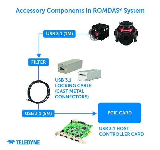
Figure 1. Accessory Components used by ROMDAS™
The computer system setup depends on the number of cameras integrated into the ROMDAS™’s system configuration. The cameras are triggered at set intervals defined by the users to capture the road information. These cameras have progressive scanning technology that displays the entire video frame with high-resolution imagery for analysis. The images are georeferenced and are viewable in post-processing software.
The system also allows for customizable image overlays that display detailed and practical information about the survey with GPS referencing for a user-friendly experience. The JPEG outputs make sure that the images are viewable in any standard media player.
“We use Bayer RG8 image capturing format for our Pavement and ROW cameras, and JPEG 12 PGR file for the 360-degree spherical cameras with image processing format: high-quality linear.” - Ben Clotworthy, DCL
Explore our Ladybug6 camera and reach out to our Spherical Imaging Specialists for any inquiries or additional information.